
Scottish Borders Region
Ros Hill - G/SB-009
Next SB Summit
Previous SB Summit
| Grid Reference | NU 08114 25324 |
| Latitude/Longitude | 55°31'17.7"N, 1°52'23.0"W |
| Maidenhead Square | IO95BM |
| Height | 315 M / 1033 ft |
| Points | 1 |
| Bonus | None |
Summary,
While Ros Hill is just 315 metres high and 7th highest in the SB summit group it is nevertheless really worth a visit.
 |
|
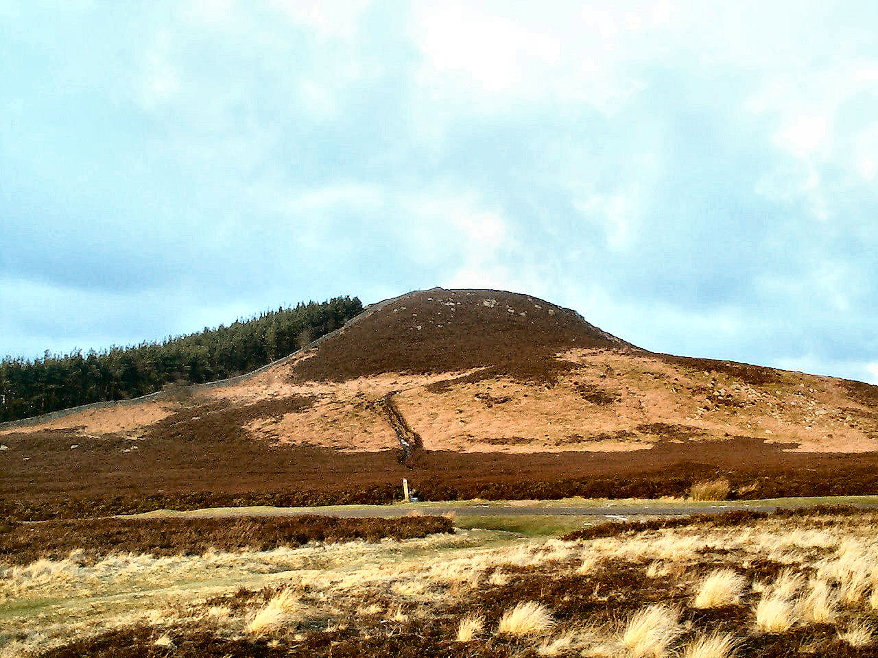
Ros hill from the south. The track and the waymark at its start, can be clearly seen going up the hill. |
This hill displays evidence of continued presence of man for over 5000 years with a cluster of bronze age rock carvings around NU 07990 25060 just off to the west of the track up to the summit. Around the summit is evidence of the rampart and ditch of an iron age hill fort.
Chillingham castle and park with its famous wild cattle is just a short distance from Ros Hill and may be worth a visit before or after an activation but also could be a good place to park the family while undertaking an activation. However ensure that you check the opening times of the park as they close between noon and 2.00pm. Another possibility for parking the family, is the Alnwick Castle and Garden, about 10 miles south east of Ros Hill, where a family can easily spend a whole day. The amazing treehouse will keep children occupied for quite some time and the intricate displays of the water gardens will also keep the family amused.
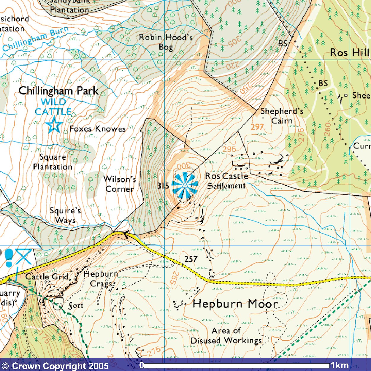
The area around Ros Hill and a strip of land leading down to the road is owned by the National Trust, but the clear track up the hill from the road does not start through the Trust land. The whole of the area from the farm at Quarry House to the trees just beyond Ros Hill on both sides of the road became "open country" from the implementation of CRoW at end May 2005. Indeed most of the vast areas of the Hepburn Moor and the Bewick Moor south of the road, is "open country".
This summit provides the shortest walking distance and the least ascent of all SB summits, with the nearby road where you park already at an altitude of 250 metres leaving only another 65 metres to the summit and about a 10 minute walk over a distance marginally more than a quarter of a mile. VHF activation is possible using a reasonable antenna, with likely contacts generally being to the south in the conurbations of Tyneside and south Northumberland. VHF QSO's into Holland have been recorded from this summit over the North Sea which takes up much of the eastern horizon. Summit to summit contacts may be possible with other SB summits, or NP and TW groups.
|
|
|
 |
|
|
© Crown
Copyright 2005 Image produced from Ordnance Survey's Get-a-map service. Image reproduced with kind permission of Ordnance Survey and Ordnance Survey of Northern Ireland. |
|
Note that "open country" is indicated by the light yellow shading
Next SB Summit
Previous SB Summit
Getting There,
From the south take the A1 north past Morpeth and Alnwick, and about 6½ miles north of Alnwick, just after the now single carriage way opens out into a short length of dual carriageway, a road on your left which you take, is signposted for Quarry House, Hepburn, North Charlton and Chillingham including the Chillingham Wild Cattle. You continue along this single track road for just over 6 miles to reach the parking spot for Ros Hill. Be aware however that this road is not always fenced and will often have sheep strolling along it. Also there are gates across the road that may be closed, so you may have to stop, open these, drive through and close them again. There is no specific parking area, just a grass verge on either side of the road.
From the north west take the A697 south off the A68 at Carfraemill passing through Coldstream, and about half way through Wooler you take a road on the left sigposted B6348 for Belford and Chatton. Continue on the B6348 ignoring the B6349 turn off to Belford, until just before Chatton, you take a road on the right signposted for Chillingham and the Wild Cattle. Continue past Chillingham Castle, unless of course you are parking the family there, and after just under a mile you take a road on the left for Hepburn and Quarry House. A mile and a half along this road you will come to Ros Hill.
From the north east take the A1 south towards
Alnwick but before reaching Alnwick, about 3 miles south of Warenford you
come to a short 1 mile long stretch of dual carriageway and just before
the end of that dual carriageway a minor road on the right, which you must
take, is signposted for North Charlton and Chillingham. Thereafter follow
the directions from the south.
Suggested Approach,
approx. walk 0.3 miles 0.5km
 |
|
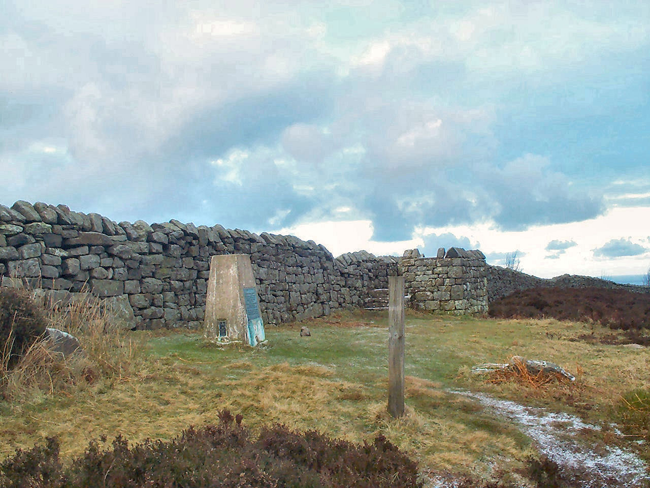
To the right of the trig point is a raised and walled observation area with metal plates on four sides identifying the surrounding landmarks. |
GPS Route Download,
Download Garmin Mapsource GDB format
»
Download Memory Map format »
Post Summit Retreat,
For refreshments after activation, the choice depends on your return direction.
The Percy Arms Hotel (open from 11:00am) at nearby Chatton would be appropriate
if returning via the A697, or alternatively there are a number of bars.
shops and fish & chip shops in Wooler where upon joining the A697 from the
B6348 you should turn left, south, then shortly after that turn sharp right
up the hill into the centre of the village. Although from the south
the recommended approach based on the quality of the road, was travelling
north via the A1 it is possible to return south via the A697 which will
join the A1 south just north of Morpeth, so the Percy Arms at Chatton could
be considered. If returning north via the A1, there is a 24hr cafe
by the Purdy Lodge at Adderstone services about 5 miles north of North Charlton
where you return to the A1. There are two pubs in the area, the Masons Arms,
at North Charlton, and the Warenford Lodge, at Warenford 4 miles north after
you return to the A1, but both of these seem to be open only in the evenings
or Sunday lunchtime.
If returning south via the A1 your best bet would be to turn off into Alnwick
where there are numerous public houses.
Last updated 10th June 2005